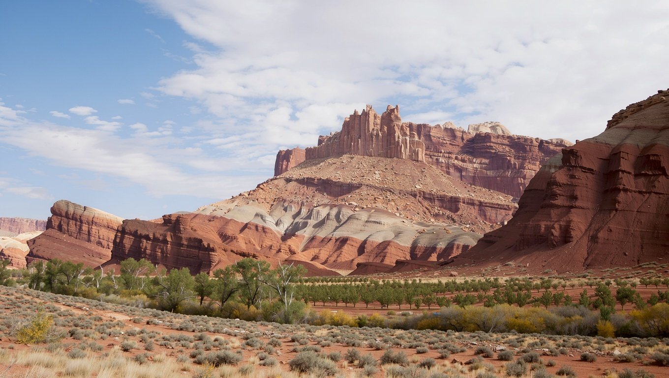
Tilted cream, grey and rust sandstone cliffs of the Waterpocket Fold in Capitol Reef National Park

South-central Utah · Near Torrey

Capitol Reef: a hundred-mile fold, and nobody there

The least visited of the Mighty 5, and the one most people wish they had given an extra day. Geology you can read like a book, orchards you can pick from, and trails you may have to yourself.

The overview

What a monocline looks like up close

Capitol Reef protects the Waterpocket Fold — a 100-mile step in the earth's crust where rock layers were pushed up and then eroded flat, exposing tilted bands of sandstone, shale and limestone in long stripes of cream, grey, ochre and rust.

Highway 24 cuts straight through the fold along the Fremont River, which means you can drive through the park's most dramatic scenery without leaving your car. That is both the appeal and the reason people underestimate it: the road is not the park.

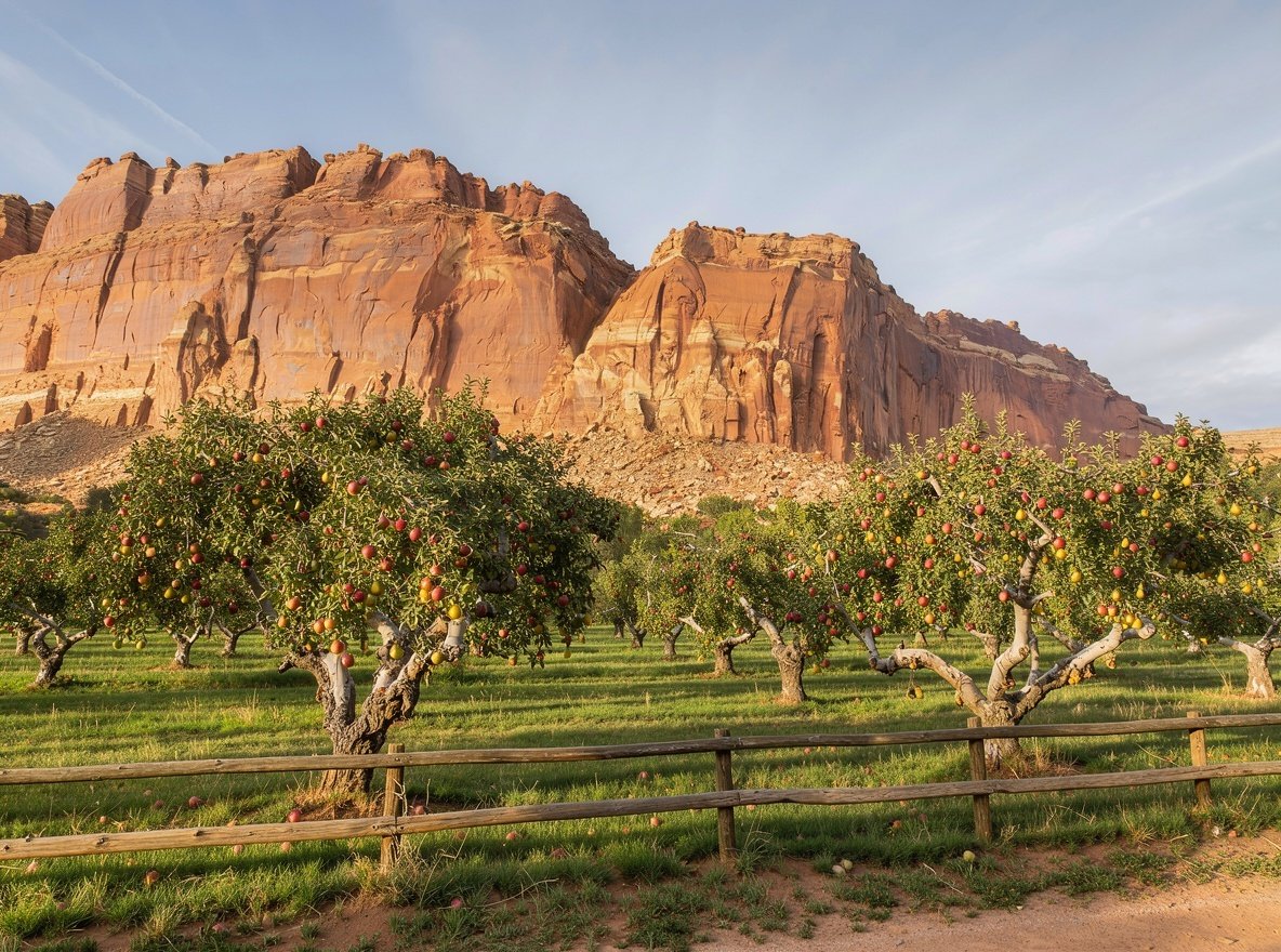
Two things make Capitol Reef distinctive. The first is that it is genuinely quiet — visitor numbers are a fraction of Zion's. The second is the historic orchards the park still maintains along the river, planted by Mormon settlers in the 1880s. In season you can pick fruit for a few dollars an honour box.

The name

The "capitol" refers to white Navajo sandstone domes that early travellers thought resembled the US Capitol building. The "reef" is the fold itself — a barrier to travel, in the old sense of a reef at sea.

The drives

Two scenic drives, wildly different

One is paved and takes an hour. The other is dirt, takes a full day, and needs the right vehicle. Both are worth it.

The paved scenic drive

An 8-mile road that leaves Highway 24 just south of the visitor centre and follows the base of the fold south, ending at Capitol Gorge. It is paved, mostly level, and lined with trailheads.

  • Stop at the petroglyph panel near the start — Fremont culture rock art, easily missed
  • The one-lane Capitol Gorge spur is worth the detour
  • Pleasant Creek Road continues beyond the pavement as a rough dirt track
  • Allow 1.5–2 hours with stops

Cathedral Valley loop

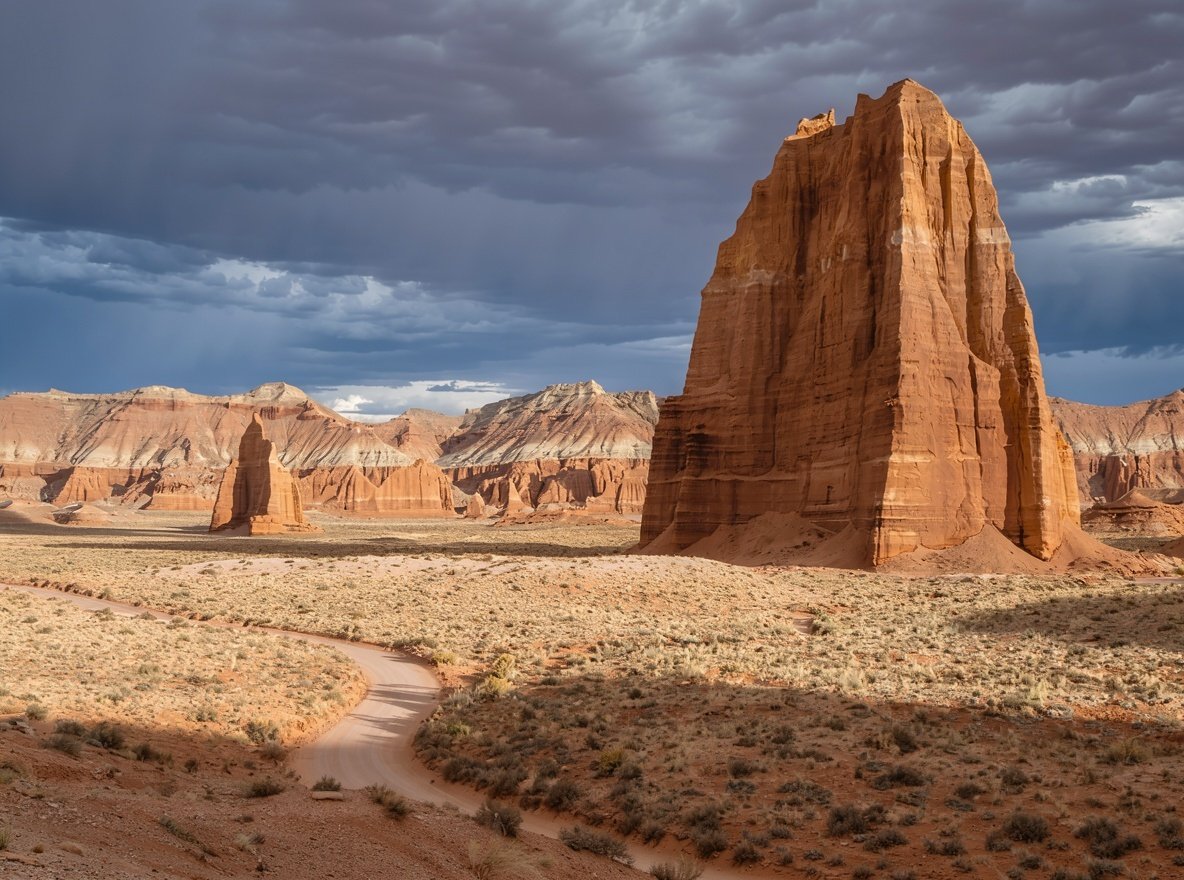
A 58-mile dirt loop north of the park through a valley of enormous sandstone monoliths. It is one of the most spectacular drives in Utah and almost nobody does it.

  • High-clearance required; impassable when wet
  • No services, no water, no mobile coverage
  • Check conditions at the visitor centre before committing
  • Allow a full day, more if you are stopping to photograph
Enormous sandstone monoliths rising from a pale desert valley floor in Cathedral Valley, Capitol Reef
Cathedral Valley is 58 miles of dirt road through monoliths. High clearance needed, and never when wet.
A historic fruit orchard with apple and pear trees in front of red sandstone cliffs
The park still maintains the Mormon-era orchards along the Fremont River. Visitors may pick fruit in season.

Trails

The hikes

Short, varied and uncrowded. Capitol Reef is a good park for people who want to walk without queuing for a car park.

Capitol Reef day hikes — distance, gain and difficulty
Trail Distance Gain Difficulty Why do it
Hickman Bridge2.9 km130 mModerateA large natural bridge and Capitol Dome views
Cassidy Arch5.3 km200 mModerateAn arch high above the valley, reached by slickrock
Capitol Gorge3.2 km60 mEasyA wash between sheer walls; pioneer inscriptions
Grand Wash7.2 km60 mEasyFlat canyon walk between towering walls
Golden Throne6.4 km230 mModerateThe park's best viewpoint payoff
Cohab Canyon2.9 km130 mModerateSlot-like shortcuts between the highway and campground

The Grand Wash and Capitol Gorge are flash-flood channels — check the forecast before entering, and never enter when storms are building.

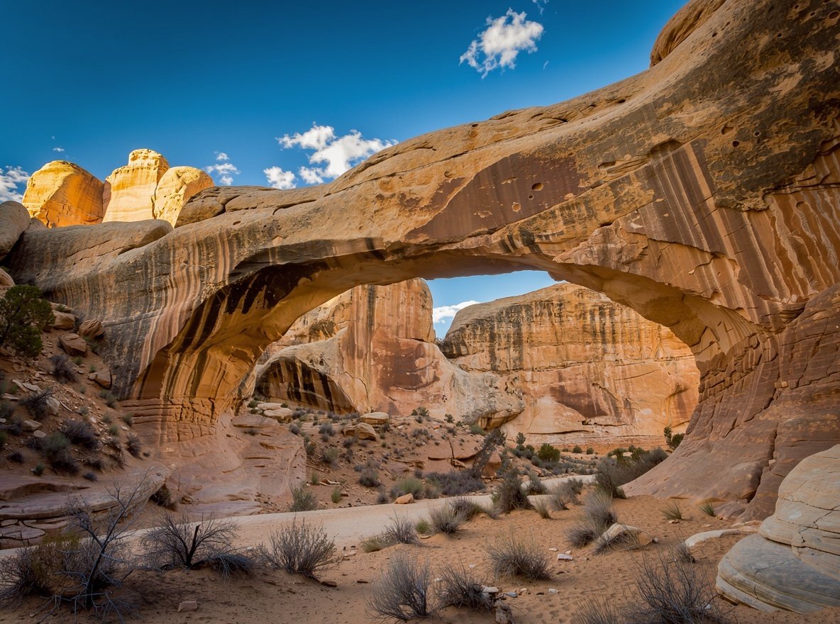
Hickman Bridge, a natural sandstone arch spanning a dry wash in Capitol Reef National Park
Hickman Bridge is the most popular short hike in the park — and still far quieter than anything in Zion.

Pick the right day

Capitol Reef sits at about 1,700 metres, which gives it a shorter season than Zion. Late spring is ideal: the orchards are in blossom, the creeks are running, and daytime temperatures sit comfortably in the low twenties.

Summer afternoons get hot and the monsoon brings sudden storms that close the dirt roads. Autumn is arguably the best window — cooler, with cottonwoods turning gold along the river.

Fruit season, roughly

Cherries late June, apricots July, peaches August, apples and pears September into October. Pick only in postmarked orchard blocks and pay at the honour box.

Getting there and where to stay

Getting there

  • From Bryce Canyon: 2 h 30 m via Scenic Byway 12 — one of the best drives in the country.
  • From Moab: 3 h 15 m via Interstate 70 and Highway 24.
  • From Salt Lake City: 3 h 30 m via Interstate 15 and Highway 24.
  • From Zion: about 4 hours — usually done via Bryce as an overnight stop.

Where to stay

  • Torrey — 18 km west, the main base, with the best dining in the area.
  • Fruita Campground — inside the park among the orchards; reserve far ahead.
  • Bicknell and Loa — smaller, cheaper, 25–35 minutes away.
  • Hanksville — east, remote, useful for Cathedral Valley.

Do not skip Route 12

Scenic Byway 12 between Bryce Canyon and Torrey climbs over Boulder Mountain at 9,600 feet and passes through Grand Staircase–Escalante. Allow a full day rather than the two and a half hours the distance suggests — you will want to stop constantly.

Capitol Reef questions

What is the Waterpocket Fold?

A monocline — a step-like fold in the earth's crust running nearly 100 miles through the park. Erosion has exposed tilted layers of sandstone, shale and limestone in long parallel bands of colour, which is what gives the park its distinctive cliffs.

How long do you need at Capitol Reef?

One day covers the scenic drive, Hickman Bridge, the petroglyphs and the orchards. Two days adds Cassidy Arch, the Cathedral Valley loop with a high-clearance vehicle, and time to sit still — which is the point of this park.

Can you pick fruit in Capitol Reef?

Yes, in season. The park maintains historic orchards along the Fremont River and lets visitors pick when fruit is ripe, for a small per-pound fee paid at an honour box. Cherries, apricots, peaches and apples ripen between June and October.

Do you need a permit for Cathedral Valley?

No permit is required for day driving, but high clearance is essential and the loop is impassable when wet. Check conditions at the visitor centre, carry water and a full tank, and tell someone your plan — there is no mobile coverage.

Is Capitol Reef worth visiting?

Yes, especially if you are already driving between Bryce and Moab. It is the quietest of the Mighty 5, and the drive through the fold on Highway 24 is one of the most striking roads in Utah. It is also the park where you are most likely to have a trail to yourself.